
Related questions
Based on MS-ESS2-3 Standards: Analyze and interpret data on the distribution of fossils and rocks, continental
shapes, and seafloor structures to provide evidence of the past plate motions.
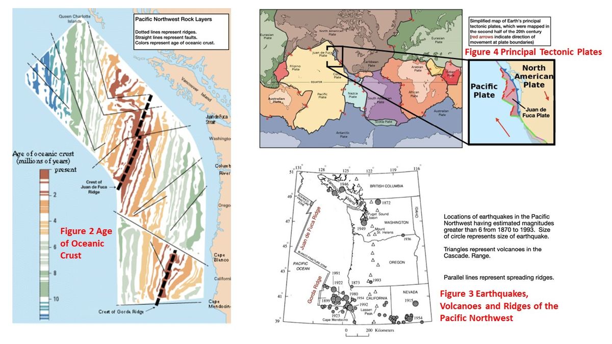
1- Based on Figure 2: Age of Oceanic Crust:
a- What information is contained in the dataset?
b- What patterns do you notice? Please use data from the figure 2 to support answer
2- Based on Figure 3 Earthquakes, Volcanoes and Ridges of the Pacific Northwest:
a- What information is contained in the dataset?
b- What patterns do you notice? Please use data from the figure 3 to support answer
3- Based on Figure 4: Principal Tectonic Plates:
a- What information is contained in the dataset?
b- What patterns do you notice? Please use data from the figure 3 to support answer


Trending nowThis is a popular solution!

Step by stepSolved in 3 steps


- Applications and Investigations in Earth Science ...Earth ScienceISBN:9780134746241Author:Edward J. Tarbuck, Frederick K. Lutgens, Dennis G. TasaPublisher:PEARSON
 Exercises for Weather & Climate (9th Edition)Earth ScienceISBN:9780134041360Author:Greg CarbonePublisher:PEARSON
 Environmental ScienceEarth ScienceISBN:9781260153125Author:William P Cunningham Prof., Mary Ann Cunningham ProfessorPublisher:McGraw-Hill Education
  Earth Science (15th Edition)Earth ScienceISBN:9780134543536Author:Edward J. Tarbuck, Frederick K. Lutgens, Dennis G. TasaPublisher:PEARSON
 Environmental Science (MindTap Course List)Earth ScienceISBN:9781337569613Author:G. Tyler Miller, Scott SpoolmanPublisher:Cengage Learning
 Physical GeologyEarth ScienceISBN:9781259916823Author:Plummer, Charles C., CARLSON, Diane H., Hammersley, LisaPublisher:Mcgraw-hill Education,