Applications and Investigations in Earth Science (9th Edition)
9th Edition
ISBN: 9780134746241
Author: Edward J. Tarbuck, Frederick K. Lutgens, Dennis G. Tasa
Publisher: PEARSON
expand_more
expand_more
format_list_bulleted
Question
thumb_up100%
Thank you in advance!!

Transcribed Image Text:COS 8-7-SP22
7. During spring, warm Mississippi River water flows into the Gulf. The fresh river water is
less dense and floats over the Gulf salt water, as shown by the light blue water layer in the
vertical cross-section starting at 2:43 min in the video. The resulting surface water layer
convection and the replenishment of dissolved oxygen in ocean water at greater
depths.
a enhances
b. prevents
c. does not change
Dissolved oxygen is essential for life in the marine food chain. With little to no oxygen, creatures
essential to the ecosystem are driven from their habitat. Species that cannot move or escape, die,
adding to the decomposition.
8. The nutrients from the Mississippi River system trigger algal blooms in the surface water
warmed by the increasingly strong sunlight during spring, which remains intense into
summer. The dead algae then sink, settle to the ocean bottom, and decompose. The
decomposition process results in the of dissolved oxygen in the deeper ocean water.
a increase
b. decrease
The Gulf of Mexico dead zone typically forms in late spring and early summer, when the
consumption of oxygen in bottom water layers cannot be resupplied by the atmosphere, and
persists until late summer or early autumn when passing storms (including hurricanes) and cooler
temperatures stir and break up the density-layered water structure. Annual research cruises have
been conducted for decades to better understand the development of hypoxis zones in the Gulf of
Mexico.
In summer 2021, the Louisiana Universities Marine Consortium's (LUMCON) research vessel
Pelican investigated hypoxia in the northern Gulf of Mexico as part of its 35 annual cruise. The
LUMCON group of scientists have monitored the maximum total dead zone area in the Gulf of
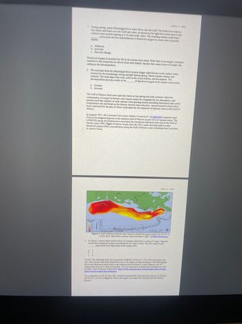
Mexico since 1985. Figure 5 depicts results from the 2021 cruise showing bottom-water
dissolved
to eastern Texas (0) concentrations along the Gulf of Mexico coast extending from Louisiana
37
COS-8-SP22
BEA
Figure 5. Gulf of Mexico bottom-water bypoxia dissolved oxygen (mg/L.) for 25 JUL to
1 AUG 2021. Black lines enclose values less than 2 mg/L. (LLMCON/NOAA)
1
b. 2
c. 4
9. In Figure 5, heavy black isolines (lines of constant value) have a value of 2 mg/L. Hypoxic
waters have dissolved oxygen concentrations of 2 mg/L, or less. The 2021 map reveals
major dead zone segment(s) in the sample area
In 2021, the total dead zone area measured 16,400 km² (6334 mi.). The 2021 total dead zone
was about on par with initial predictions due to the higher average discharge of the Mississippi
River providing more fresh water to the northern Gulf of Mexico. It still ranked as the 16
largest dead zone in 35 years of research. You can read more on dead zones and hypoxia, with
the 2021 Gulf of Mexico results here: https://www.noaa.gov/news-release larger than average
gulf-of-mexico-dead-zone-measured.
For comparison, on 24-31 July 2017 scientists measured the total dead zone area at 22,730 km²
(8776 mi), as seen in Figure 6. This is the largest ever dead zone measured for the Gulf of
Mexico.

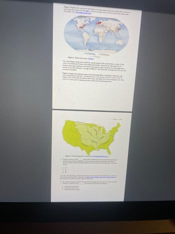
Transcribed Image Text:Figure 3 displays the worldwide distribution of major global dead zones (black dots with size in
red). Open the image with this link to zoom in on areas and view the extent of the dead zones
The Baltic Sea is the largest dead zone
Figure 3. Global dead zones. (NASA)
The second largest dead zone worldwide, and the largest in the United States, extends off the
coast of Louisiana and Texas in late spring and summer, caused by the large quantities of
nutrients from farm fertilizers, soil runoff, and organic wastes carried by the Mississippi River
system to the Gulf of Mexico. As large as 8000 mi², this dead zone is recognized for its size and
ecosystem casualties
Figure 4 displays the drainage system of the Mississippi River, including its tributaries and
major distributary (Louisiana's Atchafalaya River is not shown). This river system is the 3
largest in the world, after the Amazon and Congo, and drains 41% of the contiguous U.S. Parts
or all of 31 states and 2 Canadian provinces drain into the Mississippi River.
Figure 4. The Mississippi River watershed. (US National Park Service)
5. Farmers in parts or all of
states and 2 Canadian provinces who fertilize their land to
increase crop yield can contribute to a key stressor on marine ecosystems in the Gulf of
Mexico. Human activity far inland affects the ocean because they are both part of the same
systems
15
View the "The Dead Zone: Nutrient Runoff Creates Hypoxia in the Gulf of Mexico" by NOAA's
Environmental Visualization Laboratory at https://www.youtube.com/watch?yaac24
describes the formation of a Gulf of Mexico dead zone.
6. The satellite imagery (at about 2:00 min) shows red (high nutrient) water as it enters the Gulf
of Mexico, where they flow. The nutrients then initiate algal blooms.
a castward toward Florida
b. westward toward Texas
northward toward Canada
Expert Solution
This question has been solved!
Explore an expertly crafted, step-by-step solution for a thorough understanding of key concepts.
Step by stepSolved in 2 steps

Knowledge Booster
Recommended textbooks for you
 Applications and Investigations in Earth Science ...Earth ScienceISBN:9780134746241Author:Edward J. Tarbuck, Frederick K. Lutgens, Dennis G. TasaPublisher:PEARSON
 Exercises for Weather & Climate (9th Edition)Earth ScienceISBN:9780134041360Author:Greg CarbonePublisher:PEARSON
 Environmental ScienceEarth ScienceISBN:9781260153125Author:William P Cunningham Prof., Mary Ann Cunningham ProfessorPublisher:McGraw-Hill Education
 Earth Science (15th Edition)Earth ScienceISBN:9780134543536Author:Edward J. Tarbuck, Frederick K. Lutgens, Dennis G. TasaPublisher:PEARSON
 Environmental Science (MindTap Course List)Earth ScienceISBN:9781337569613Author:G. Tyler Miller, Scott SpoolmanPublisher:Cengage Learning
 Physical GeologyEarth ScienceISBN:9781259916823Author:Plummer, Charles C., CARLSON, Diane H., Hammersley, LisaPublisher:Mcgraw-hill Education,

Applications and Investigations in Earth Science ...
Earth Science
ISBN:9780134746241
Author:Edward J. Tarbuck, Frederick K. Lutgens, Dennis G. Tasa
Publisher:PEARSON

Exercises for Weather & Climate (9th Edition)
Earth Science
ISBN:9780134041360
Author:Greg Carbone
Publisher:PEARSON

Environmental Science
Earth Science
ISBN:9781260153125
Author:William P Cunningham Prof., Mary Ann Cunningham Professor
Publisher:McGraw-Hill Education

Earth Science (15th Edition)
Earth Science
ISBN:9780134543536
Author:Edward J. Tarbuck, Frederick K. Lutgens, Dennis G. Tasa
Publisher:PEARSON

Environmental Science (MindTap Course List)
Earth Science
ISBN:9781337569613
Author:G. Tyler Miller, Scott Spoolman
Publisher:Cengage Learning

Physical Geology
Earth Science
ISBN:9781259916823
Author:Plummer, Charles C., CARLSON, Diane H., Hammersley, Lisa
Publisher:Mcgraw-hill Education,