Related questions
Question
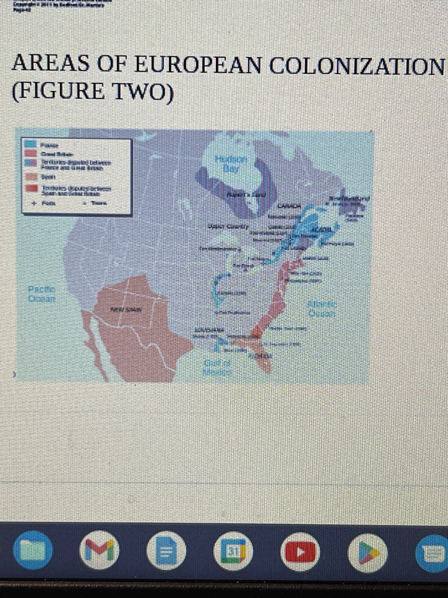
How do you account for the geographical locations of the Spanish, French, and British colonies as pictured in the map below (c. 1680)?in 250 words

Transcribed Image Text:ONTHLIITT
P
AREAS OF EUROPEAN COLONIZATION
(FIGURE TWO)
FINGE
Seal Brides
FRIDERS FR
HIMICE NIER BEEND
between
Tukes upRST SEİROSE
SANTINGSALTENE
PMK
NEW SAR
LEN
PEN
10000
EVELY
(
Expert Solution
This question has been solved!
Explore an expertly crafted, step-by-step solution for a thorough understanding of key concepts.

Step by stepSolved in 3 steps
