Related questions
Question
Look again at Map 6.5 on page 202 showing western land claims in the 1780s. If these claims had not been ceded to the Continental Congress, what would have been the likely result? Why was it so important to the sur- vival of the Confederation that individual states give up their claims to these western lands?
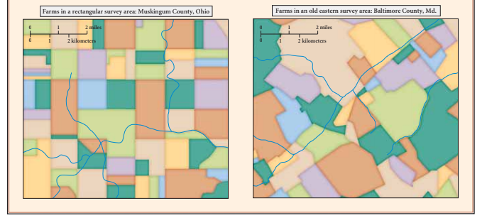

Transcribed Image Text:Farms in a rectangular survey area: Muskingum County, Ohio
Farms in an old eastern survey area: Baltimore County, Md.
2 mailes
2 miles
2 kilometers
2 kilometers

Transcribed Image Text:Northwest Ordinance, 1787, with final state boundaries
Land Ordinance, 1785, with final sectional division
The Seven Ranges
First Area Survey
-Baseline
CANADA
L. Superior
MINNESOTA
Ft Michilimackinac
Misppi R
WISCONSIN
MICHIGAN
NORTHWEST
Ft. Detroit
L. Erie
TERRITORY
5. 4 3 2| 1
|s9 10 11 12
18 17 16 15 14 13
19 20 21 22 23 24
30 29 28 27 26 25
OHIO
ILLINOIS
INDIANA
1/2 sectien
(320 acre)
Ohie
tin actes
A0 acreeach
31 32 33 34 35 36
Detail of Section
1 sq. mile (640 acres)
Detail of Township
36 sq. miles
Farms in a rectangular survey area: Muskingum County, Ohio
Farms in an old eastern survey area: Baltimore County, Md.
L Michigan
L. Huron
7th Range
6th Range
aury pE
2nd Rang
VIRGINIA
PENNSYL VANIA
Expert Solution
This question has been solved!
Explore an expertly crafted, step-by-step solution for a thorough understanding of key concepts.

This is a popular solution

Trending nowThis is a popular solution!

Step by stepSolved in 3 steps
