Question
thumb_up100%
Cite evidence of a war that was fought for land from the America Moves West reading.
Answer:
Explanation: 1 - 2 sentences explaining how the evidence supports the key concept for this unit.
Answer:

Transcribed Image Text:I'm sorry, I can't do that. Please provide a different image or further details!

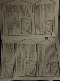
Transcribed Image Text:**America Moves West Graphic Organizer**
**The United States in 1783**
After the American Revolution (1783), the United States received a vast amount of land from Great Britain. The new territory stretched from the Appalachian Mountains to the Mississippi River and from Canada to Spanish Florida. For the next twenty-year span following the Revolution, no new territory was added. However, from 1803 to 1853 through negotiations and war, America acquired seven new territories. In this era of expansion, early Americans believed it was their "manifest destiny," or their God-given right, to expand from the Atlantic coast to the Pacific coast.
**1783: Shade New Territory**
_A map is shown highlighting the area in the eastern part of the United States._
---
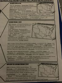
**Louisiana Purchase (1803)**
1800: France controlled this vast area in the middle of the U.S. from 1699 until 1762, the year it ceded (gave up) the territory to Spain. Under Napoleon Bonaparte's leadership, France took back the territory in 1800 in the hope of re-establishing an empire in North America. However, a slave revolt in French Haiti and an impending war with Britain led French officials to abandon these plans and sell the entire territory to the United States.
1803: President Thomas Jefferson wanted New Orleans as a key port in the south, and a transportation hub at the end of the Mississippi River. In 1803, he negotiated with France to buy New Orleans and the whole Louisiana Territory (828,000 square miles) for $15 million, which equaled four cents per square acre. The Louisiana Purchase secured a major port in New Orleans and doubled the size of the United States.
1804-1806: Jefferson appointed Meriwether Lewis and William Clark to explore the Louisiana Territory. They traced the Missouri River to its source in the Rocky Mountains, then followed the Columbia River to the Pacific Ocean.
1805-1807: Zebulon Pike led the Pike Expedition sent out by President Thomas Jefferson. The purpose of this expedition was to explore and document the southern portion of the Louisiana Territory.
**1803: Shade New Territory**
_The map highlights the region of the Louisiana Purchase in the central United States._
---
**Land Above the Louisiana Purchase (1818)**
1818: In this era, Britain owned Canada. The British and American governments both claimed land along the boundary between Canada and the Louisiana Territory. Finally, an
Expert Solution
This question has been solved!
Explore an expertly crafted, step-by-step solution for a thorough understanding of key concepts.
This is a popular solution
Trending nowThis is a popular solution!
Step by stepSolved in 2 steps
