Related questions
Question
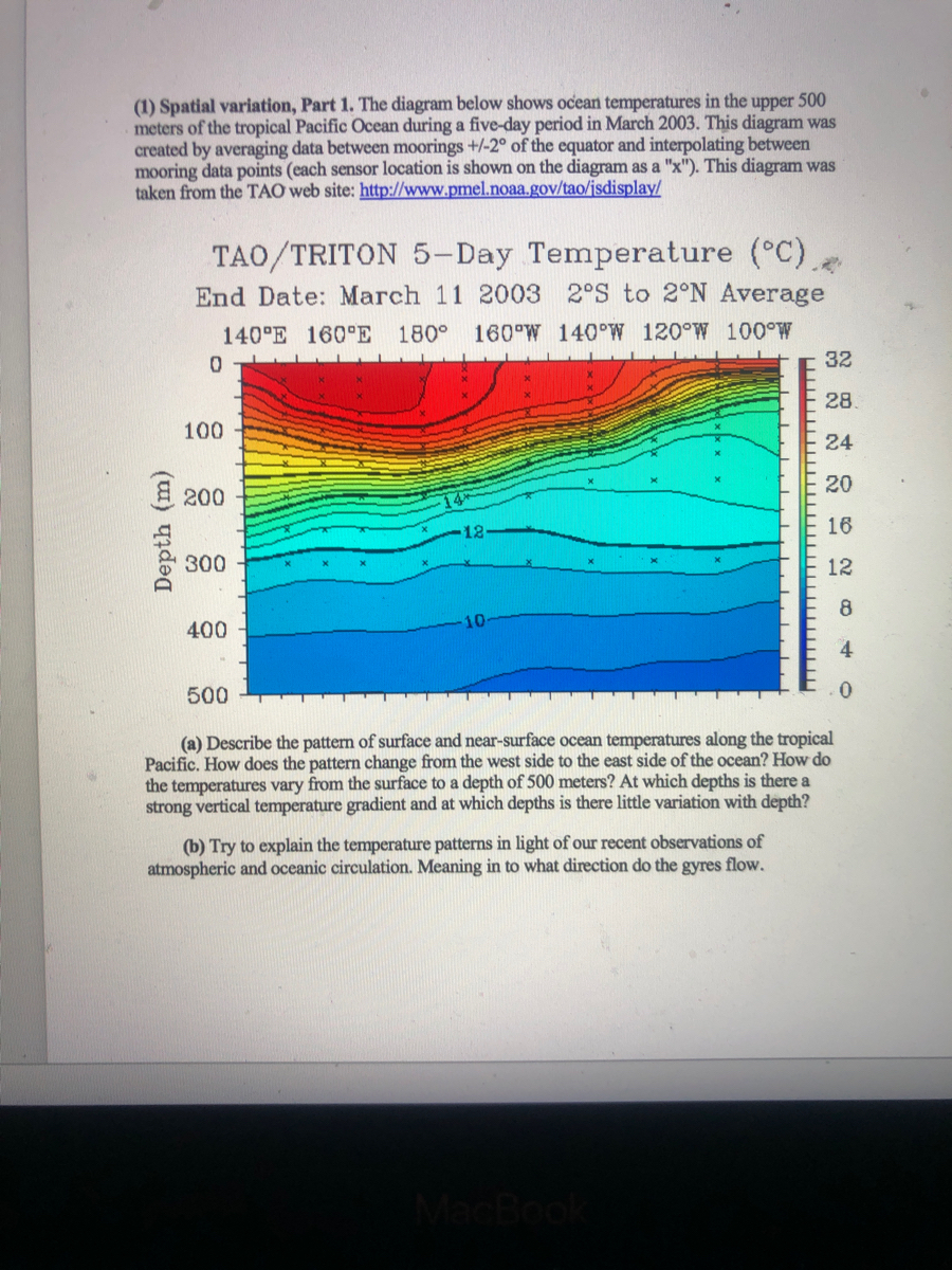

Transcribed Image Text:(1) Spatial variation, Part 1. The diagram below shows ocean temperatures in the upper 500
meters of the tropical Pacific Ocean during a five-day period in March 2003. This diagram was
created by averaging data between moorings +/-2° of the equator and interpolating between
mooring data points (each sensor location is shown on the diagram as a "x"). This diagram was
taken from the TẠO web site: http://www.pmel.noaa.gov/tao/jsdisplay/
TAO/TRITON 5-Day Temperature (°C).
End Date: March 11 2003 2°S to 2°N Average
140°E 160°E 180° 160°W 140°W 120°W 100°W
32
28
100
24
E200
20
16
300
12
8
400
4
500
(a) Describe the pattern of surface and near-surface ocean temperatures along the tropical
Pacific. How does the pattern change from the west side to the east side of the ocean? How do
the temperatures vary from the surface to a depth of 500 meters? At which depths is there a
strong vertical temperature gradient and at which depths is there little variation with depth?
(b) Try to explain the temperature patterns in light of our recent observations of
atmospheric and oceanic circulation. Meaning in to what direction do the gyres flow.
MacBook
Depth (m)
Expert Solution
This question has been solved!
Explore an expertly crafted, step-by-step solution for a thorough understanding of key concepts.

This is a popular solution

Trending nowThis is a popular solution!

Step by stepSolved in 3 steps
